
Written by Alchemy’s custom bike painter, Phil Harwood.
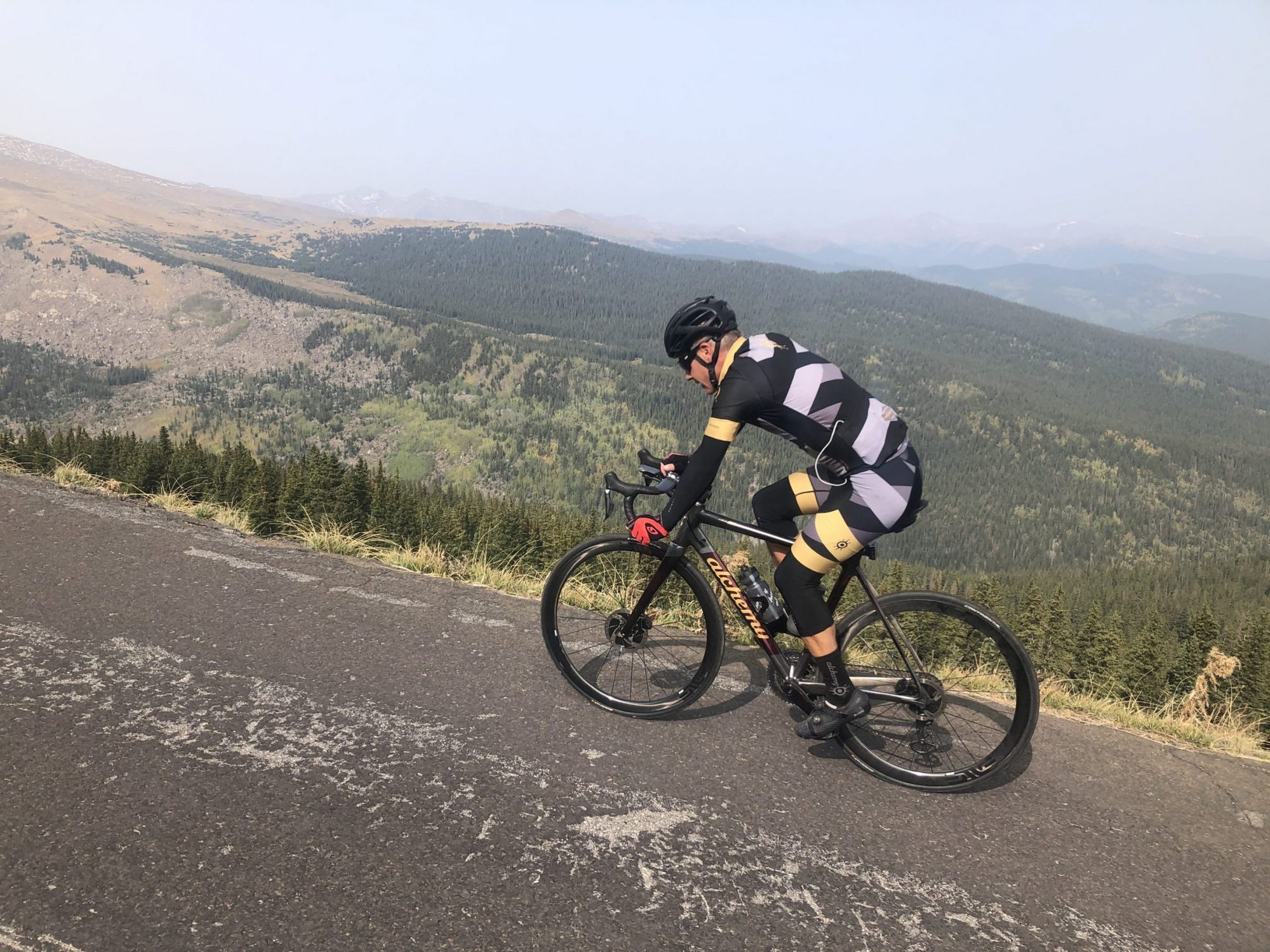
This top 5 is for all the mountain goats out there! At Alchemy, we are truly lucky to live, work and play so close to these giant climbs, which can humble beginner and expert riders alike with high elevations, leg-breaking steeps, punishing winds, and unexpected storms.
Pack a rain jacket and keep a careful eye on daylight and weather conditions, and you can experience majestic wildlife, stunning views, and the personal satisfaction of cresting a monster climb.
As colder weather approaches, the window to ride some of these climbs is beginning to close, but the good news is that the first three climbs are rideable year-around (as long as the sun is shining and it's not too cold for the ride back down the mountain)!
High Grade
10.6 miles 2,700 feet elevation gain 4.8% avg gradient
https://www.strava.com/segments/612959
Starting southwest of Denver near Chatfield State Park, this is a popular big climb that features a fully stocked rest area at the top with picnic tables, coolers full of water, Gatorade and cookies, as well as a clean port-o-potty. Bring some cash for the donation station as you will greatly appreciate hydration after slogging up this monster climb!
There is street parking along the Deer Creek Canyon Road, near the intersection with Wadsworth, and the ride can be made into a fantastic loop by cruising a long and flowy descent from Conifer, on to Evergreen, and down Bear Creek Canyon to Red Rocks and Morrison.
The ridgeline views are spectacular, traffic is relatively light, and the C-470 bike trail can get you to the climb from Denver's sprawling bike path network.
Bonus – the mini burritos at the Kittredge General Store (HWY 74 in Kittredge) are an excellent mid-ride snack before the descent to Morrison.
 Morrison to Brook Forest
18.9 miles, 3,062 feet elevation gain, 3.1% avg gradient
https://www.strava.com/segments/7855306
This climb starts just outside of Red Rocks Park in Morrison, and winds up scenic Bear Creek Canyon through picturesque small mountain towns, through downtown Evergreen, and finishes on the steep slopes of Black Mountain Road, just below 9,000 feet!
The first part of the climb is pretty mellow, incredibly beautiful, and often heavily trafficked on summer weekends. The second part gets more rural, surrounded by dense green forests, and features views of the abandoned Evergreen Ski Area.
This is easily done as an out and back (hello, 19-mile descent!), or a lollipop by continuing on to descend Shadow Mountain into Conifer, and turning left on Hwy 73 for a smooth descent back through Evergreen, and on down the canyon back to Morrison.
Street and bike path parking is usually easy to find in Morrison, and connecting to the Bear Creek and CT-470 bike trails is a breeze.
Bonus – make this a big day by adding in High Drive climb, a short steep switchback filled climb with incredible views to the north west including Mt Evans, and the Continental Divide.
Morrison to Brook Forest
18.9 miles, 3,062 feet elevation gain, 3.1% avg gradient
https://www.strava.com/segments/7855306
This climb starts just outside of Red Rocks Park in Morrison, and winds up scenic Bear Creek Canyon through picturesque small mountain towns, through downtown Evergreen, and finishes on the steep slopes of Black Mountain Road, just below 9,000 feet!
The first part of the climb is pretty mellow, incredibly beautiful, and often heavily trafficked on summer weekends. The second part gets more rural, surrounded by dense green forests, and features views of the abandoned Evergreen Ski Area.
This is easily done as an out and back (hello, 19-mile descent!), or a lollipop by continuing on to descend Shadow Mountain into Conifer, and turning left on Hwy 73 for a smooth descent back through Evergreen, and on down the canyon back to Morrison.
Street and bike path parking is usually easy to find in Morrison, and connecting to the Bear Creek and CT-470 bike trails is a breeze.
Bonus – make this a big day by adding in High Drive climb, a short steep switchback filled climb with incredible views to the north west including Mt Evans, and the Continental Divide.
 Golden Gate Canyon
11.1 miles, 2,764 feet elevation gain, 4.7% avg gradient
https://www.strava.com/segments/5099278
Starting from the famous front range city of Golden, this climb goes almost straight west and up into beautiful mountains and forests. This climb is a little steeper and harder than the last two, which also equals a faster descent on the way down.
The scenery is amazing the whole way, and traffic is usually moderate. A few big switchbacks and a quick dip downhill about two-thirds of the way up transition into an unfriendly combination of a stiff headwind and steep grades that really make you earn the summit of the climb, which occurs at 9,000 feet and is marked by the “Entering Gilpin County” sign (shortly past the aptly named Lone Eagle Drive on the right hand side).
Options abound for incredible gravel lollipop routes, with Drew Hill and Crawford Gulch to the north, and Smith and Robinson Roads to the south. For a long out and back, there is a camp store 6 miles further on, or for a really big day ride Mt Base to Gap Road (gravel) and descend Coal Creek Canyon back down towards the plains.
Bonus – Finish at Cannonball Creek Brewing at the base of the climb in North Golden. There is lots of outdoor seating, and a rotating platoon of food trucks make this a great post ride finish.
Golden Gate Canyon
11.1 miles, 2,764 feet elevation gain, 4.7% avg gradient
https://www.strava.com/segments/5099278
Starting from the famous front range city of Golden, this climb goes almost straight west and up into beautiful mountains and forests. This climb is a little steeper and harder than the last two, which also equals a faster descent on the way down.
The scenery is amazing the whole way, and traffic is usually moderate. A few big switchbacks and a quick dip downhill about two-thirds of the way up transition into an unfriendly combination of a stiff headwind and steep grades that really make you earn the summit of the climb, which occurs at 9,000 feet and is marked by the “Entering Gilpin County” sign (shortly past the aptly named Lone Eagle Drive on the right hand side).
Options abound for incredible gravel lollipop routes, with Drew Hill and Crawford Gulch to the north, and Smith and Robinson Roads to the south. For a long out and back, there is a camp store 6 miles further on, or for a really big day ride Mt Base to Gap Road (gravel) and descend Coal Creek Canyon back down towards the plains.
Bonus – Finish at Cannonball Creek Brewing at the base of the climb in North Golden. There is lots of outdoor seating, and a rotating platoon of food trucks make this a great post ride finish.
 Juniper Pass
From Evergreen 14.7 miles, 3,318 feet elevation gain, 4.3% avg gradient
From Idaho Springs 12.7 miles, 3,152 feet elevation gain, 4.6% avg gradient
https://www.strava.com/segments/775882
This ride is locally referred to as Squaw Pass, but the true high mountain pass is named Juniper, topping out at a lung-busting 11,000 feet!
This is one of the prettiest roads in the front range, if not the entire state, or even country. Smooth tarmac, painted bike lanes for parts of the climb, beautiful scenery, sweeping curves, panoramic views for days, a high alpine lake (Echo Lake), trees, mountains, and more trees, and more mountains!
This is best done as a loop, either starting from Evergreen or Idaho Springs. I like starting in Evergreen and climbing the east side, as the road follows a ridgeline of several big mountains, Squaw, Warrior, and Chief, is less steep and therefore a little easier to enjoy the expansive views as you ascend. The descent into Idaho Springs is an absolute blast! Make sure your tires and brakes are in good condition, as speeds on this downhill increase quickly!
If you choose to start from Idaho Springs, the first 7 miles feature a false flat like gradient, before you hit the first switchbacks at Chicago Creek and begin to tilt upward towards the skies. Great views of Mt. Evans, and Echo Lake at 10,000 feet. If you climb this way, the official segment ends at the lake, but there is actually 3 more miles and 500 feet of climbing to reach the unmarked summit of Juniper Pass.
Either way, each side rates a 10/10 for both the ascents and descents and high mountain splendor and suffering!
Bonus – Pie at Echo Lake Lodge (when open, check before you go)
Finish beers and food can be found on either end, check out Evergreen Brewing in Evergreen, and West Bound and Down in Idaho Springs.
Juniper Pass
From Evergreen 14.7 miles, 3,318 feet elevation gain, 4.3% avg gradient
From Idaho Springs 12.7 miles, 3,152 feet elevation gain, 4.6% avg gradient
https://www.strava.com/segments/775882
This ride is locally referred to as Squaw Pass, but the true high mountain pass is named Juniper, topping out at a lung-busting 11,000 feet!
This is one of the prettiest roads in the front range, if not the entire state, or even country. Smooth tarmac, painted bike lanes for parts of the climb, beautiful scenery, sweeping curves, panoramic views for days, a high alpine lake (Echo Lake), trees, mountains, and more trees, and more mountains!
This is best done as a loop, either starting from Evergreen or Idaho Springs. I like starting in Evergreen and climbing the east side, as the road follows a ridgeline of several big mountains, Squaw, Warrior, and Chief, is less steep and therefore a little easier to enjoy the expansive views as you ascend. The descent into Idaho Springs is an absolute blast! Make sure your tires and brakes are in good condition, as speeds on this downhill increase quickly!
If you choose to start from Idaho Springs, the first 7 miles feature a false flat like gradient, before you hit the first switchbacks at Chicago Creek and begin to tilt upward towards the skies. Great views of Mt. Evans, and Echo Lake at 10,000 feet. If you climb this way, the official segment ends at the lake, but there is actually 3 more miles and 500 feet of climbing to reach the unmarked summit of Juniper Pass.
Either way, each side rates a 10/10 for both the ascents and descents and high mountain splendor and suffering!
Bonus – Pie at Echo Lake Lodge (when open, check before you go)
Finish beers and food can be found on either end, check out Evergreen Brewing in Evergreen, and West Bound and Down in Idaho Springs.
 Mt Evans 27.5 miles, 6,510 feet elevation gain, 4.5% avg gradient
https://www.strava.com/segments/642991
The hardest mountain stage of a grand tour is referred to as the “Queen Stage”, and Mt. Evans is the true Queen of the front range! The hardest, highest, most iconic road in the front range is of course the highest paved road on the entire continent of North America!
Topping out just above 14,000 feet, this a true beast of a climb, leaving treeline far below for miles and miles of high alpine tundra, inhabited by wild flowers, marmots, mountain goats, and snowfields. This climb features everything a pure climber could want, epic scenery, wonderful wildlife, steep ramps, switchbacks on switchbacks, lung busting elevation, and jaw dropping views in all directions. It is hard, it hurts, but is always worth the effort!
Pro Tips – carry extra water, and extra layers for the descent. Even in mid summer you will need a jacket and gloves to ride back down this climb.
See the Bob Cook Memorial Hill Climb for more info! https://bicyclerace.com/
Disclosure - Expect road closures for rockfall mitigation on Hwy 74, Bear Creek Canyon, on weekdays for the rest of this year. Road will be open normally on weekends.
Looking for even more Colorado road bike adventures? Check out Phil's top 5 Colorado road rides.
Mt Evans 27.5 miles, 6,510 feet elevation gain, 4.5% avg gradient
https://www.strava.com/segments/642991
The hardest mountain stage of a grand tour is referred to as the “Queen Stage”, and Mt. Evans is the true Queen of the front range! The hardest, highest, most iconic road in the front range is of course the highest paved road on the entire continent of North America!
Topping out just above 14,000 feet, this a true beast of a climb, leaving treeline far below for miles and miles of high alpine tundra, inhabited by wild flowers, marmots, mountain goats, and snowfields. This climb features everything a pure climber could want, epic scenery, wonderful wildlife, steep ramps, switchbacks on switchbacks, lung busting elevation, and jaw dropping views in all directions. It is hard, it hurts, but is always worth the effort!
Pro Tips – carry extra water, and extra layers for the descent. Even in mid summer you will need a jacket and gloves to ride back down this climb.
See the Bob Cook Memorial Hill Climb for more info! https://bicyclerace.com/
Disclosure - Expect road closures for rockfall mitigation on Hwy 74, Bear Creek Canyon, on weekdays for the rest of this year. Road will be open normally on weekends.
Looking for even more Colorado road bike adventures? Check out Phil's top 5 Colorado road rides.
Morrison to Brook Forest
18.9 miles, 3,062 feet elevation gain, 3.1% avg gradient
https://www.strava.com/segments/7855306
This climb starts just outside of Red Rocks Park in Morrison, and winds up scenic Bear Creek Canyon through picturesque small mountain towns, through downtown Evergreen, and finishes on the steep slopes of Black Mountain Road, just below 9,000 feet!
The first part of the climb is pretty mellow, incredibly beautiful, and often heavily trafficked on summer weekends. The second part gets more rural, surrounded by dense green forests, and features views of the abandoned Evergreen Ski Area.
This is easily done as an out and back (hello, 19-mile descent!), or a lollipop by continuing on to descend Shadow Mountain into Conifer, and turning left on Hwy 73 for a smooth descent back through Evergreen, and on down the canyon back to Morrison.
Street and bike path parking is usually easy to find in Morrison, and connecting to the Bear Creek and CT-470 bike trails is a breeze.
Bonus – make this a big day by adding in High Drive climb, a short steep switchback filled climb with incredible views to the north west including Mt Evans, and the Continental Divide.
Golden Gate Canyon
11.1 miles, 2,764 feet elevation gain, 4.7% avg gradient
https://www.strava.com/segments/5099278
Starting from the famous front range city of Golden, this climb goes almost straight west and up into beautiful mountains and forests. This climb is a little steeper and harder than the last two, which also equals a faster descent on the way down.
The scenery is amazing the whole way, and traffic is usually moderate. A few big switchbacks and a quick dip downhill about two-thirds of the way up transition into an unfriendly combination of a stiff headwind and steep grades that really make you earn the summit of the climb, which occurs at 9,000 feet and is marked by the “Entering Gilpin County” sign (shortly past the aptly named Lone Eagle Drive on the right hand side).
Options abound for incredible gravel lollipop routes, with Drew Hill and Crawford Gulch to the north, and Smith and Robinson Roads to the south. For a long out and back, there is a camp store 6 miles further on, or for a really big day ride Mt Base to Gap Road (gravel) and descend Coal Creek Canyon back down towards the plains.
Bonus – Finish at Cannonball Creek Brewing at the base of the climb in North Golden. There is lots of outdoor seating, and a rotating platoon of food trucks make this a great post ride finish.
Juniper Pass
From Evergreen 14.7 miles, 3,318 feet elevation gain, 4.3% avg gradient
From Idaho Springs 12.7 miles, 3,152 feet elevation gain, 4.6% avg gradient
https://www.strava.com/segments/775882
This ride is locally referred to as Squaw Pass, but the true high mountain pass is named Juniper, topping out at a lung-busting 11,000 feet!
This is one of the prettiest roads in the front range, if not the entire state, or even country. Smooth tarmac, painted bike lanes for parts of the climb, beautiful scenery, sweeping curves, panoramic views for days, a high alpine lake (Echo Lake), trees, mountains, and more trees, and more mountains!
This is best done as a loop, either starting from Evergreen or Idaho Springs. I like starting in Evergreen and climbing the east side, as the road follows a ridgeline of several big mountains, Squaw, Warrior, and Chief, is less steep and therefore a little easier to enjoy the expansive views as you ascend. The descent into Idaho Springs is an absolute blast! Make sure your tires and brakes are in good condition, as speeds on this downhill increase quickly!
If you choose to start from Idaho Springs, the first 7 miles feature a false flat like gradient, before you hit the first switchbacks at Chicago Creek and begin to tilt upward towards the skies. Great views of Mt. Evans, and Echo Lake at 10,000 feet. If you climb this way, the official segment ends at the lake, but there is actually 3 more miles and 500 feet of climbing to reach the unmarked summit of Juniper Pass.
Either way, each side rates a 10/10 for both the ascents and descents and high mountain splendor and suffering!
Bonus – Pie at Echo Lake Lodge (when open, check before you go)
Finish beers and food can be found on either end, check out Evergreen Brewing in Evergreen, and West Bound and Down in Idaho Springs.
Mt Evans 27.5 miles, 6,510 feet elevation gain, 4.5% avg gradient
https://www.strava.com/segments/642991
The hardest mountain stage of a grand tour is referred to as the “Queen Stage”, and Mt. Evans is the true Queen of the front range! The hardest, highest, most iconic road in the front range is of course the highest paved road on the entire continent of North America!
Topping out just above 14,000 feet, this a true beast of a climb, leaving treeline far below for miles and miles of high alpine tundra, inhabited by wild flowers, marmots, mountain goats, and snowfields. This climb features everything a pure climber could want, epic scenery, wonderful wildlife, steep ramps, switchbacks on switchbacks, lung busting elevation, and jaw dropping views in all directions. It is hard, it hurts, but is always worth the effort!
Pro Tips – carry extra water, and extra layers for the descent. Even in mid summer you will need a jacket and gloves to ride back down this climb.
See the Bob Cook Memorial Hill Climb for more info! https://bicyclerace.com/
Disclosure - Expect road closures for rockfall mitigation on Hwy 74, Bear Creek Canyon, on weekdays for the rest of this year. Road will be open normally on weekends.
Looking for even more Colorado road bike adventures? Check out Phil's top 5 Colorado road rides.


Leave a comment (all fields required)